<drawing> The Four Corners of Korea
This map of the Korean Peninsula merges several human and physical patterns that characterize the variable appearance of the Peninsula's landscape and the sea that surrounds it. The map also locates some of the activities of Korea's people that are set in this framework. Several of the map elements exhibit different scales and generalization of the patterns that are selectively emphasized for a broad geographic understanding of Korea at a glance. Each of the four insets in the corners of the map show a small, detailed image of the four corner areas that are the limits of the Korean domain and the range of landscapes that are home to its people.
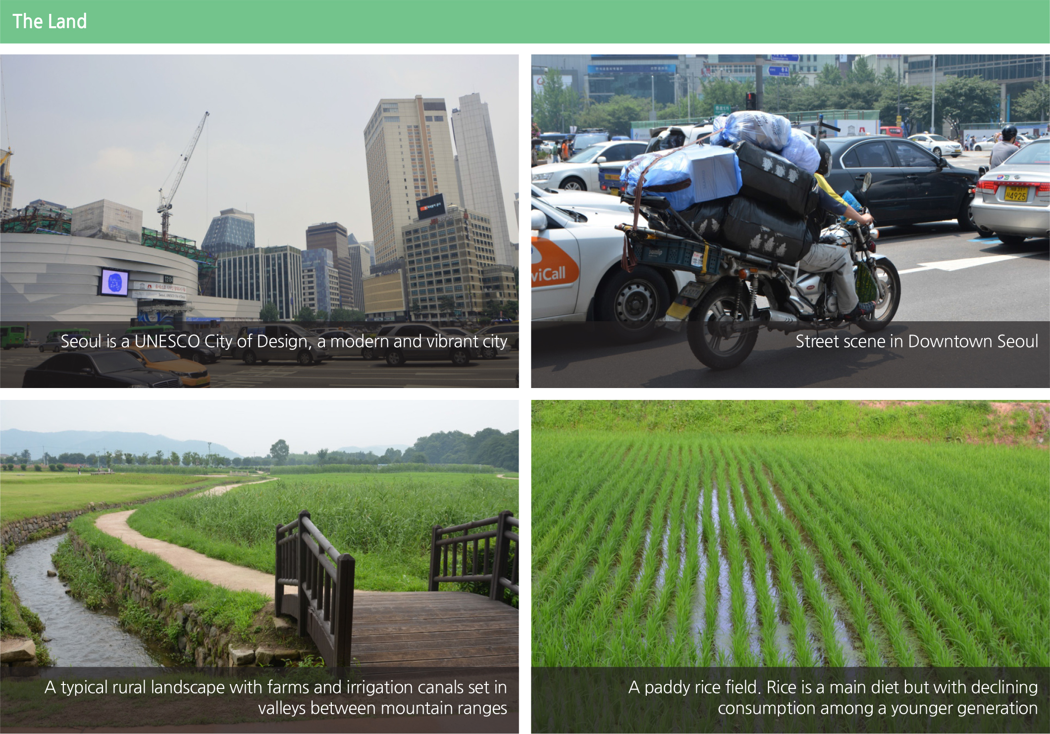
The Land: The general pattern of the terrain of Korea is shown in colors ranging from light green for the lower terrain, grading through a yellow green for the higher areas, to a light brown/tan for the highest mountainous areas. These colors were chosen so that their light visual appearance would not conflict with rivers, cities and highways.
The highest mountains of Korea are in the northeast and continue northward into China. As we move southward on the Peninsula the land is lower and the higher elevations are more dissected with rivers contained in broader lower valleys. The lowland coastal area in the east and south is narrow, with the largest area of lowland in the northwest. The pattern of coastal islands in the south and west of the Peninsula suggests a geologic pattern of dissection extending westward into the Yellow Sea in contrast to the very few islands on the east coast, suggesting an uplifting land and a steeper coastal shelf.
<photograph> Seoul is a UNESCO City of Design, a modern and vibrant city
<photograph> Street scene in Downtown Seoul
<photograph> A typical rural landscape with farms and irrigation canals set in
valleys between mountain ranges
<photograph> A paddy rice field. Rice is a main diet but with declining
consumption among a younger generation
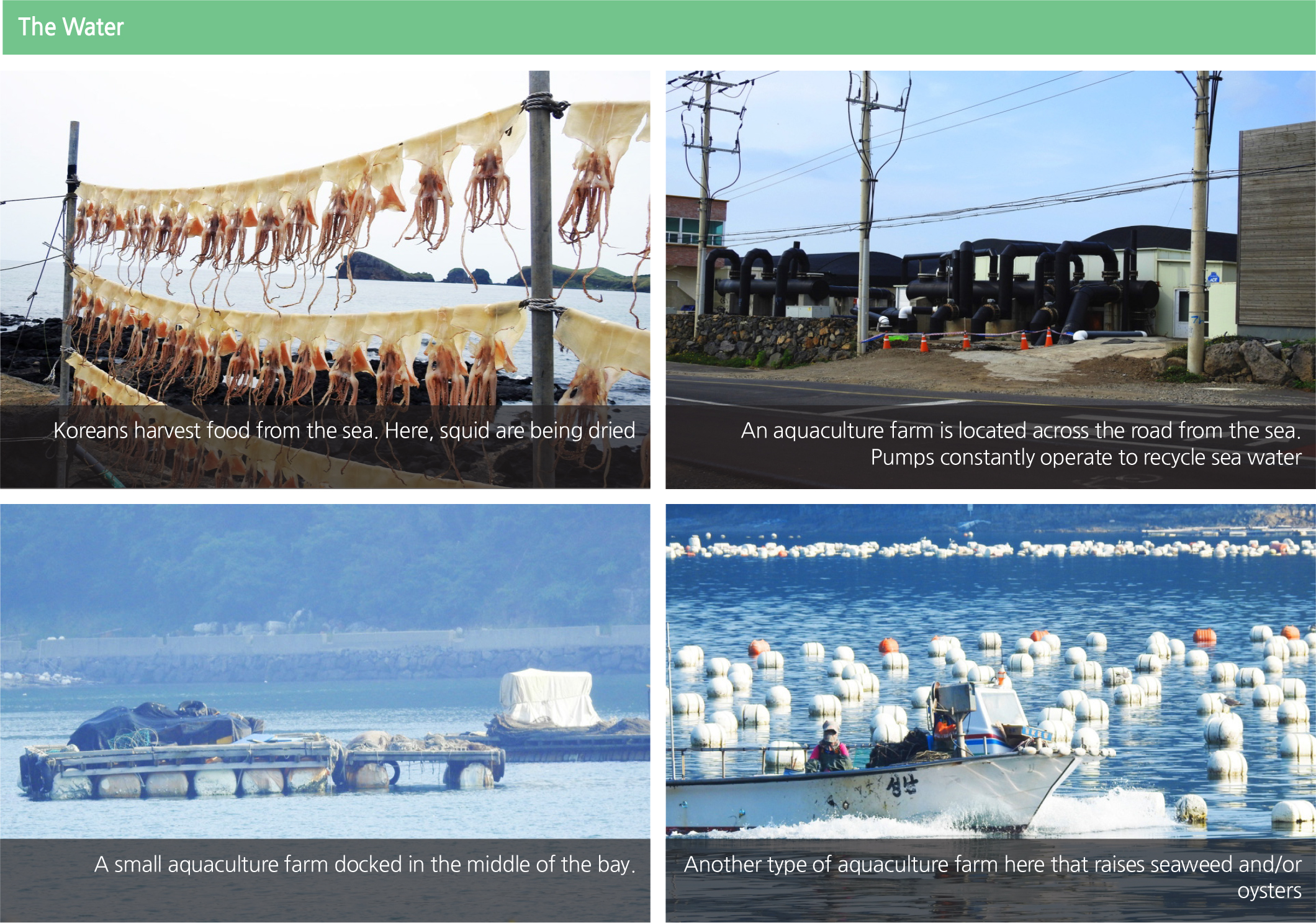
The Water: The seas and ocean that surround Korea are shown in a very generalized form with four different undefined depths. The seafloor is not smooth as implied in its symbolization here but is variable and dissected with an underwater surface almost as detailed as the land terrain.
The rivers are shown in a very thin generalized blue line on this map without distinctions made to their real size and the many situations where they have been changed by dams and other modifications. The patterns of the rivers are important to the landscape of Korea since they represent important methods for transportation and tools for the erosion of the land and the locations of periodic disruptive flooding. The rivers are shown in dark blue to create a strong con trast with the terrain while insuring that they are visible against the patterns of human activity on the landscape.
<photograph> Koreans harvest food from the sea. Here, squid are being dried
<photograph> An aquaculture farm is located across the road from the sea.
Pumps constantly operate to recycle sea water
<photograph> A small aquaculture farm docked in the middle of the bay.
<photograph> Another type of aquaculture farm here that raises seaweed and/or
oysters
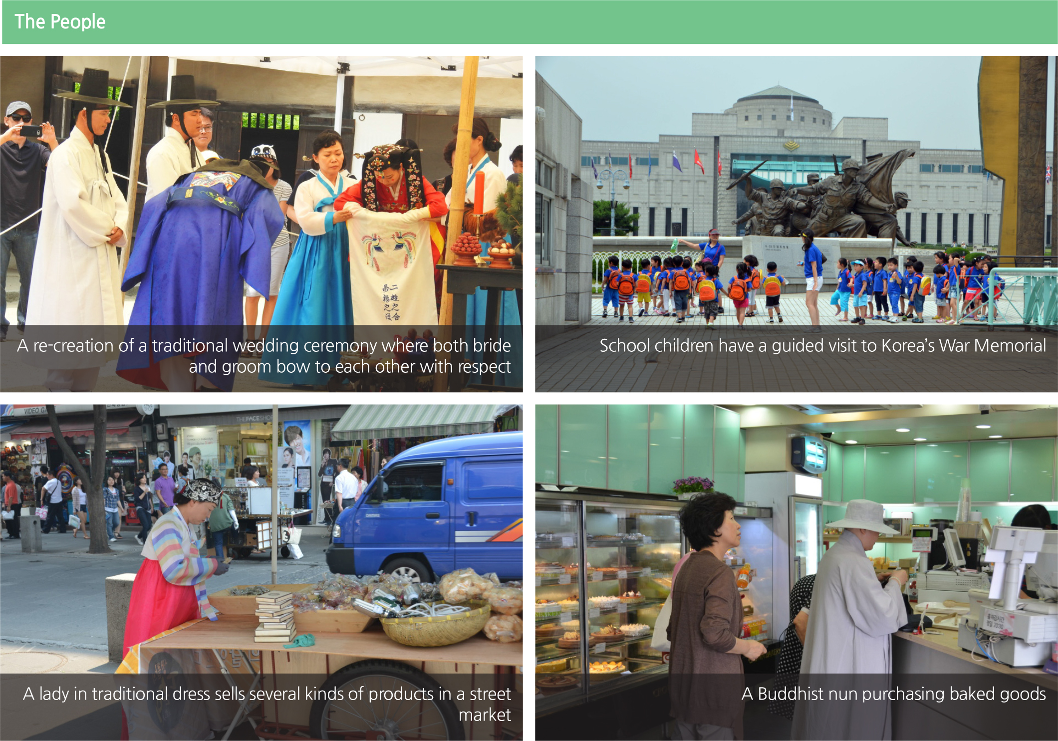
The People: One might consider that human activities dominate the landscape of Korea. While human activity is probably the defining aspect of modern Korea, it is especially difficult to present its different components on a small-scale generalized map without overwhelming the other, nonhuman aspects of Korea.
<photograph> A re-creation of a traditional wedding ceremony where both bride
and groom bow to each other with respect
<photograph> School children have a guided visit to Korea’s War Memorial
<photograph> A lady in traditional dress sells several kinds of products in a street
market
<photograph> A Buddhist nun purchasing baked goods
Brief Interpretation of the Map
The seaward extent of all regions and nations that border the sea can be a controversial point of international debate. On this map, a Straight Baseline and a Territorial Water Line are shown prominently. A Straight Baseline is drawn in coastal areas of great indentations and/or with numerous small, scattered islands. Points are first identified on land or on islands and then joined to form the baseline. Such a baseline can then be used to define or delineate territorial waters. The Territorial Water Line sets the territorial limit of a nation’'s sovereignty. Sovereignty refers to the land, sea, and air space that belong to the nation; under international law, these spaces cannot be violated or accessed without permission. Offshore islands that belong to a nation also have delineated territorial water lines to limit that nation’'s sovereignty. In the case of South Korea, the Territorial Water Lines are clearly marked for Ulleungdo and Dokdo Islands on this map.
The next aspect of human activity illustrated on this map of Korea is the concentration of people in urban areas. While Korea has a significant portion of its population living outside major cities, these people are not shown here. Major transportation routes are shown in somewhat visually subdued symbols on this map display. Some might argue that the highways and trains are the defining component of human activity in Korea, but this is a very small map. However, it highlights questions of which aspects of geographic reality drive the others.
This type of map is very difficult to construct and even more difficult to interpret, yet it is important to study for broad patterns. This map is only an introduction to the hundreds of other maps in this atlas series. This series concentrates of human activities that will detail other aspects of Korea's daily life. But the fact that it is such a difficult map to construct accurately does not mean it should be ignored. It is useful to return to this page often to put the details from subsequent pages and maps in the series in a broad context for understanding Korea and its geographic patterns.